If you were born in the last 30 years, there’s a good chance you’ve never actually had to rely on a paper map. You might have seen them at amusement parks or folded up in the glove compartment of your dad’s car. But you probably weren’t using them to navigate from the passenger seat while on a road trip with your best friend.
Despite the fact that the majority of the world now uses apps to provide us with directions, there will always be a place for maps. And if you disagree, I hope that the Amazing Maps Instagram page will help change your mind. This account has amassed nearly 75K followers for sharing fascinating maps of the world, along with fun facts and interesting statistics. Below, you’ll find some of their most intriguing posts, so be sure to upvote all of your favorites. And keep reading to find conversations with map experts Ivos Gajdorus from Mapotic and Minas, Creator of MapChart!
More info: Facebook | XClick here & follow us for more lists, facts, and stories.
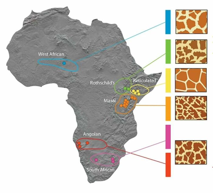
#1 Regional Giraffe Patterns
© Photo: amazingmap
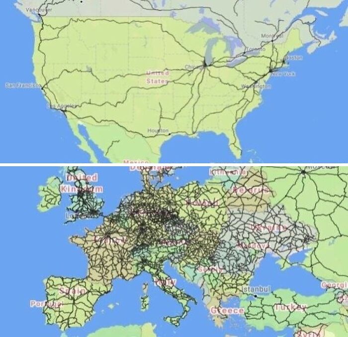
#2 Passenger Trains In The United States vs. Europe
© Photo: amazingmap
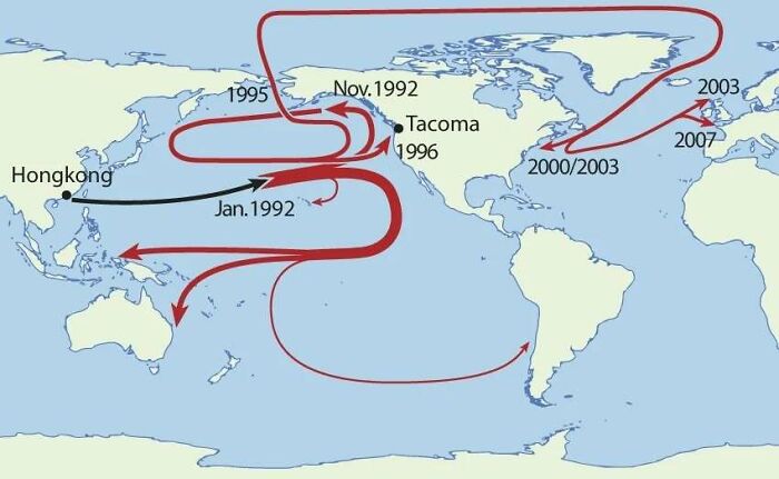
#3 In 1992, Around 29,000 Rubber Ducks Fell Off A Cargo Ship In The Pacific Ocean. This Is Where They Made Landfall
© Photo: amazingmap
To learn more about maps from an expert, we got in touch with Ivos Gajdorus from Mapotic. Mapotic is a startup driving geospatial innovation since 2018. Originally launched as an interactive map builder for creators and communities, it has evolved into a platform delivering custom B2B mapping solutions.
By fusing satellite, IoT, location, and metadata from various sources, Mapotic creates powerful, user-friendly web and mobile applications. And today, it serves sectors including wildlife tracking, travel and tourism, logistics, and civic projects.
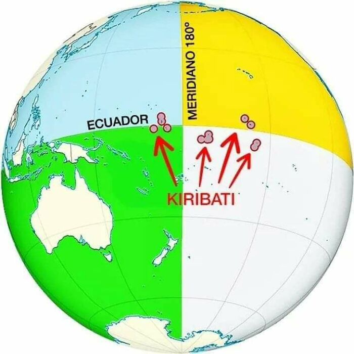
#4 Kiribati Is The Only Country In The World That Is In All Four Hemispheres
© Photo: amazingmap
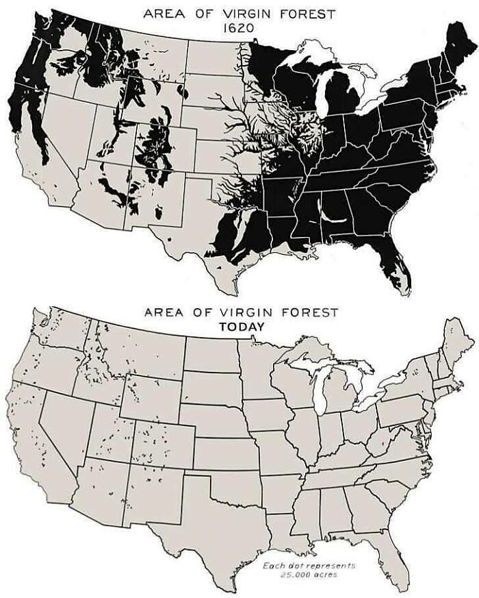
#5 Virgin Forest Cover 1620 vs. Today
© Photo: amazingmap
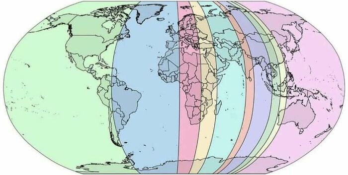
#6 Each Section Has 10% Of The World’s Population
© Photo: amazingmap
First, we wanted to hear why Ivos believes maps are so important. “The question of ‘where’ is deeply embedded in most human activities,” he shared. “Maps are a powerful form of visual interpretation that help us make sense of locations — especially those we are not familiar with. They turn complex spatial information into something understandable and usable.”
We also asked the expert if he happens to have a favorite map. “One of the most impactful maps powered by the Mapotic platform is the Ocearch Shark Tracker, which helps the global community better understand changes in our oceans by tracking the movement and behavior of sharks. They reveal patterns and shifts we would otherwise miss.”
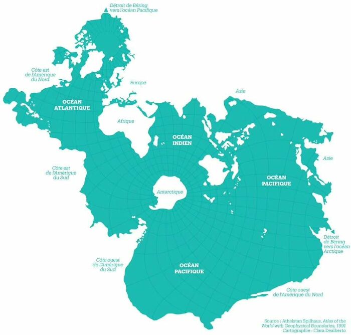
#7 The Spilhaus Projection. In 1942, Athelstan Spilhaus Produced A World Map With A Unique Perspective, Presenting The World’s Oceans As One Body Of Water
© Photo: amazingmap
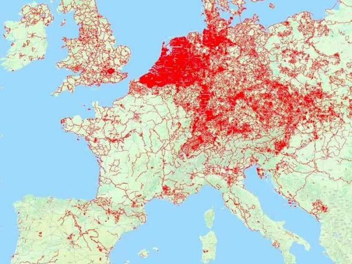
#8 Cycle Paths Of Europe
© Photo: amazingmap
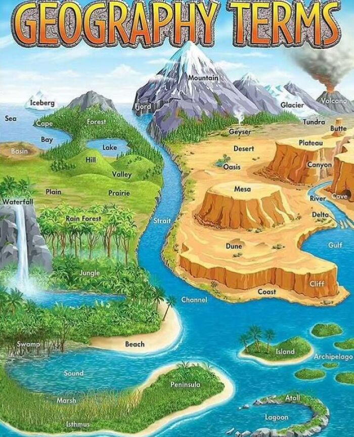
#9 A Map Of Geography Terms. Any You Didn’t Know?
© Photo: amazingmap
If you’re interested in making your own maps, Ivos shared some advice. “Before creating a map, think carefully about the information structure,” he shared. “Maps are just one way to interpret data, and thoughtful categorization and classification are key for building complex maps that are easy to navigate and understand.”
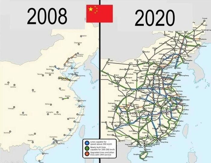
#10 Railways In China, 2008 vs. 2020
© Photo: amazingmap
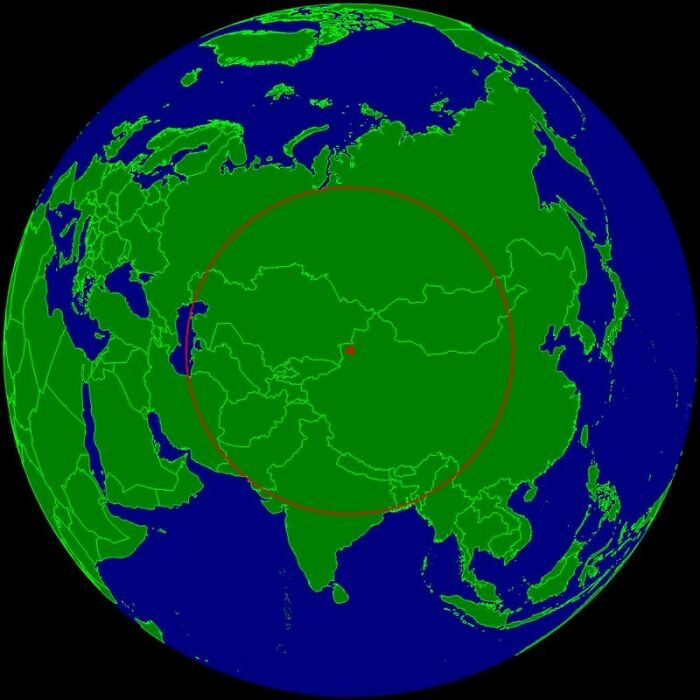
#11 Xinjiang, China. The Farthest Place On Earth From Any Ocean
© Photo: amazingmap
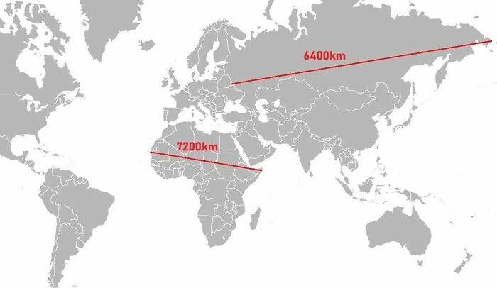
#12 A Map Comparing Actual Distances To Their Representation On The Mercator Projection
© Photo: amazingmap
Finally, Ivos shared a fun fact about ancient maps. “According to many sources, the oldest known map dates back around 25,000 years. It was carved into a mammoth tusk and discovered in Pavlov, Czech Republic — proof that even prehistoric people didn’t like getting lost.”
You can learn even more about the topic right here!
#13 Obesity In North America (2021)
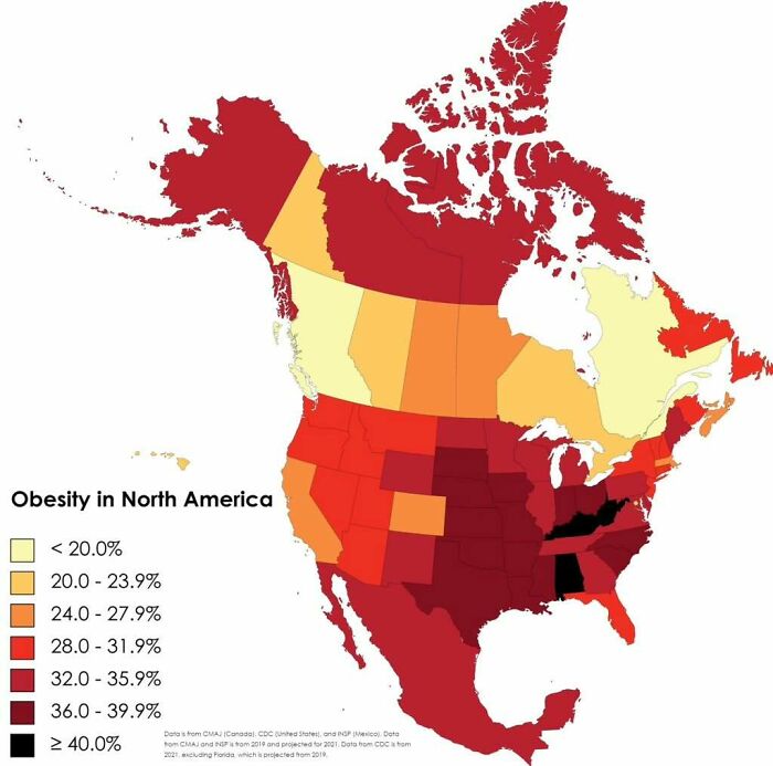
© Photo: amazingmap
#14 Comparing The Urban Areas Of European Capitals
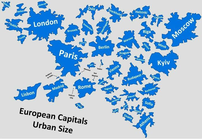
© Photo: amazingmap
#15 Historical And Current Grizzly Bear Range In North America
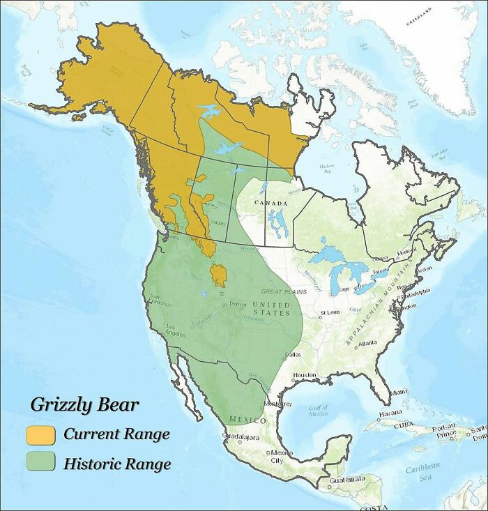
© Photo: amazingmap
We were also lucky enough to get in touch with Minas, the creator of MapChart, to hear his thoughts on this topic. “Maps help us make sense of the world. They turn complex data into something visual and understandable,” he explained. “Whether it’s for education, planning, or just curiosity, maps help people connect with information in a more meaningful way.”
#16 Countries Where Cheek Kissing Is A Common Greeting
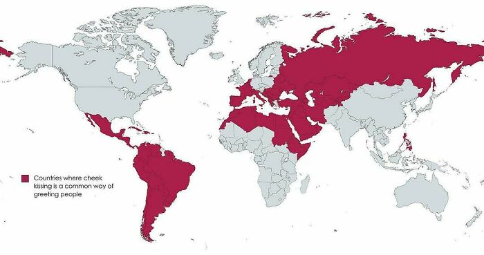
© Photo: amazingmap
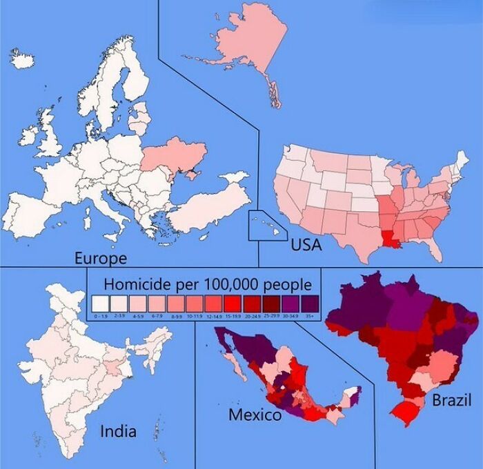
#17 Homicide Rates In Different Regions Of The World
© Photo: amazingmap
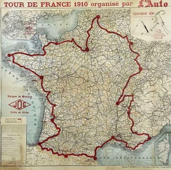
#18 Map Of The 1910 Tour De France Route
© Photo: amazingmap
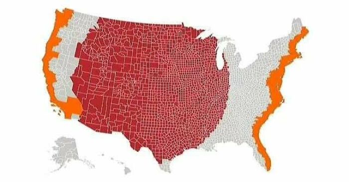
We were also curious about Minas’ favorite map. “One map that always stands out to me is the ‘World divided into 4 regions with the same population’. It’s such a simple idea, but incredibly eye-opening. It challenges your assumptions about population distribution and gives a powerful visual of how unevenly people are spread across the planet.”
#19 The Red And Orange Areas Have Equal Population
© Photo: amazingmap
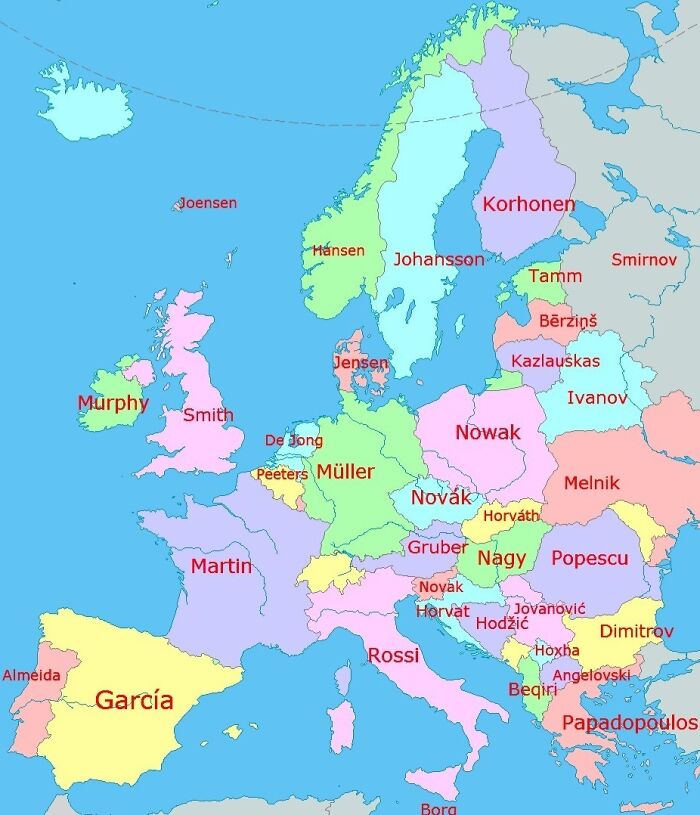
#20 A Map Of Europe’s Most Common Surnames
© Photo: amazingmap
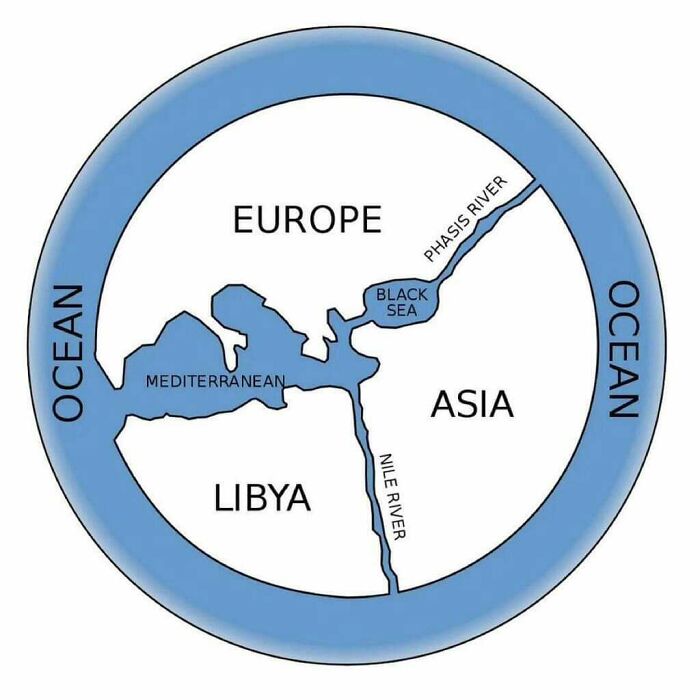
#21 The First World Map By Anaximander Of Miletus (610bc-546bc), Greek Philosopher
© Photo: amazingmap
And if you’re interested in trying your hand at map making, Minas recommends starting simple and focusing on clarity. “You don’t need to be a designer or a GIS expert to make a compelling map,” he shared. “Tools like MapChart let you get started right away, even with no experience. The most important thing is to have a clear purpose or story you want your map to tell.”
Finally, the expert added that he’s always impressed by the creativity people show when making maps. “From fictional worlds to data-driven insights, the possibilities are endless.”
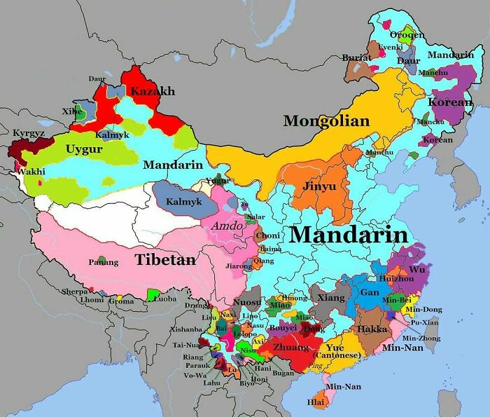
#22 Map Of Languages Spoken In China
© Photo: amazingmap
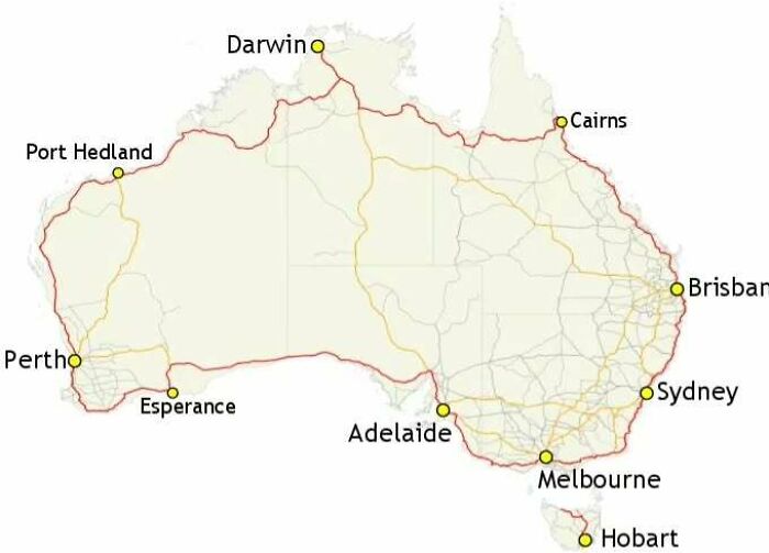
#23 Highway 1 In Australia. The Longest National Highway In The World At Around 14,500km
© Photo: amazingmap
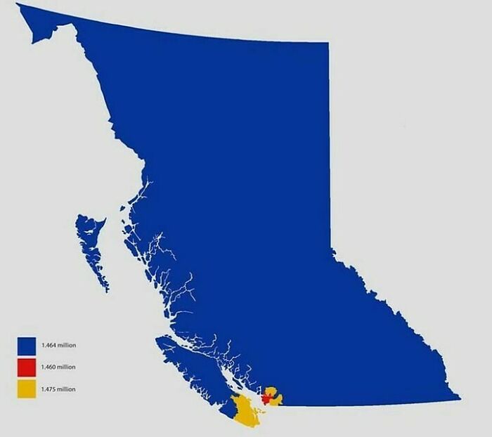
#24 Dividing British Columbia Into Three Regions With Equal Population
© Photo: amazingmap
We hope you’re enjoying this list of fascinating maps, pandas! Keep upvoting all of your favorites, and let us know in the comments down below what the most interesting map you’ve ever seen was. Then, if you’d like to check out even more maps that will teach you something new about our world, we’ve got the perfect Bored Panda list for you to read next right here!
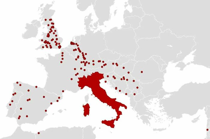
#25 Location Of Every City Founded By The Roman Empire, Outside Of Italy
© Photo: amazingmap
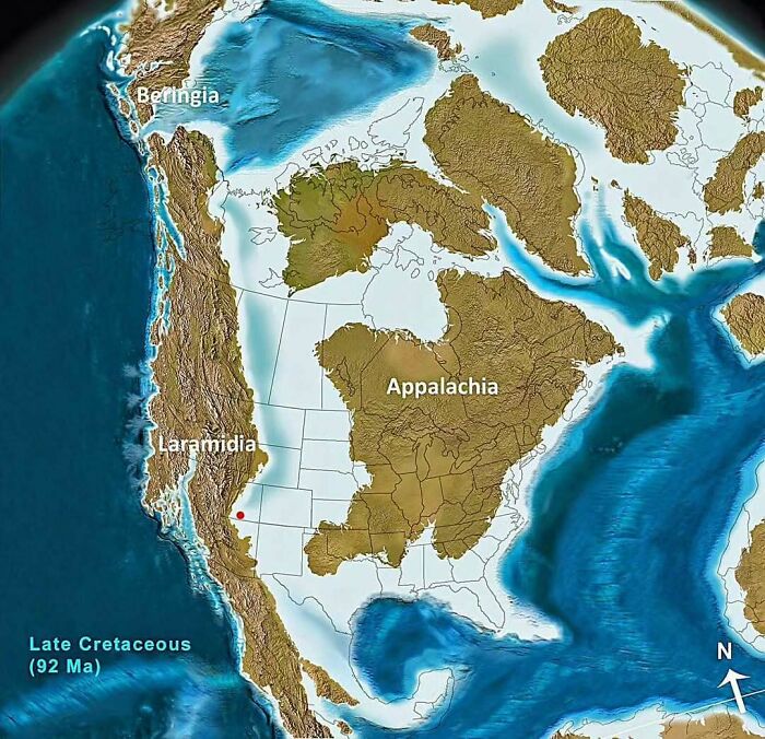
#26 North America 92 Million Years Ago
© Photo: amazingmap
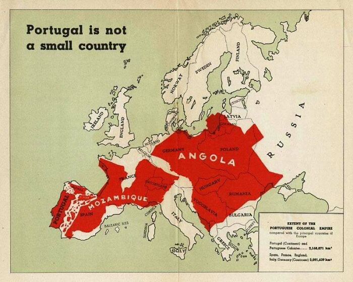
#27 A Portuguese Propaganda Poster Showing The Size Of Portuguese Colonial Possessions Compared To Europe
© Photo: amazingmap
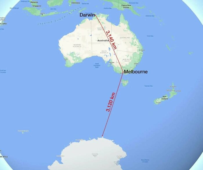
#28 Melbourne Is Closer To Antarctica Than It Is To Darwin
© Photo: amazingmap
#29 The Roundest Countries
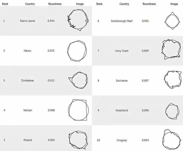
© Photo: amazingmap
#30 The 25 Largest Lakes In The World, Side By Side
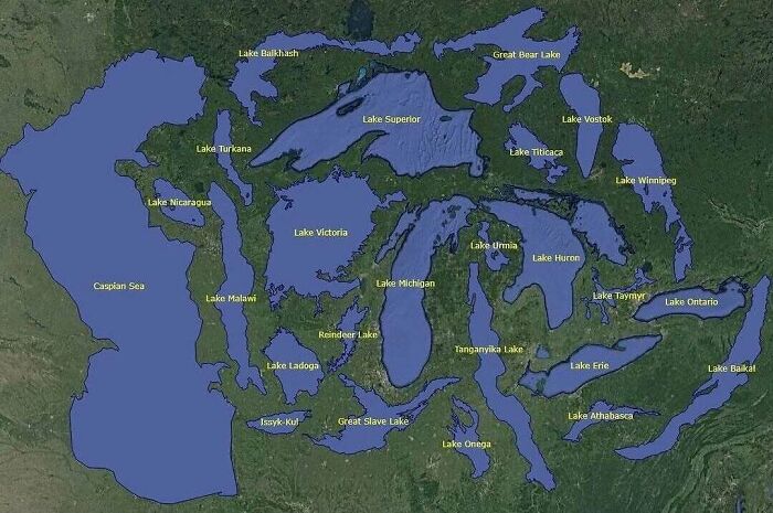
© Photo: amazingmap
#31 United States Gdp, Split In Half
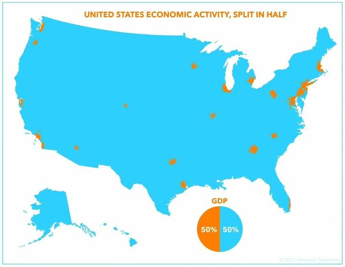
© Photo: amazingmap
#32 The Distance From Perth To Sydney Is Greater Than The Distance From Paris To Moscow
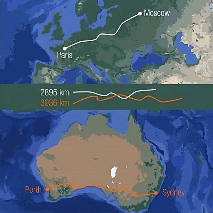
© Photo: amazingmap
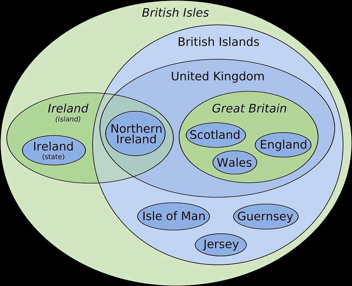
#33 A Euler Diagram-Map Of The British Isles
© Photo: amazingmap
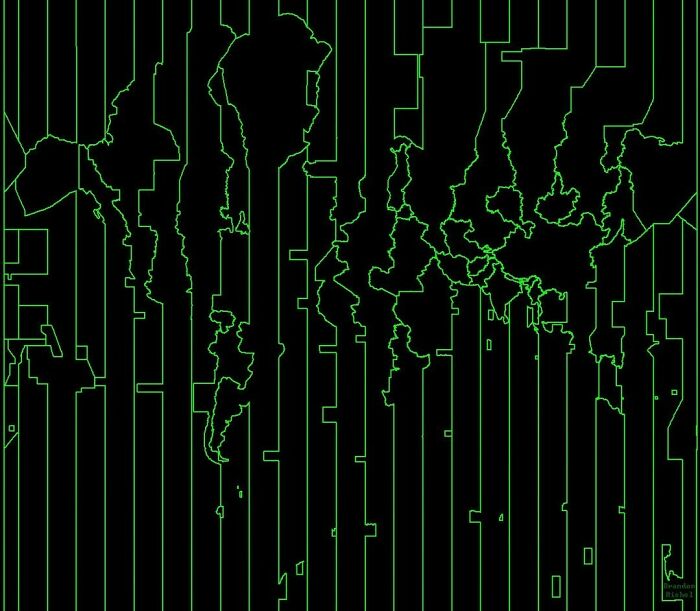
#34 A Map Of The World Constructed From Time Zones
© Photo: amazingmap
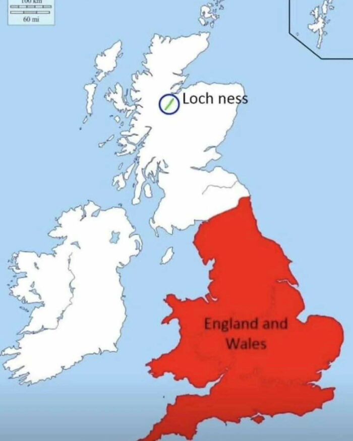
#35 There’s More Water In Loch Ness Than In All Of England And Wales’ Lakes, Rivers, And Reservoirs Combined
© Photo: amazingmap
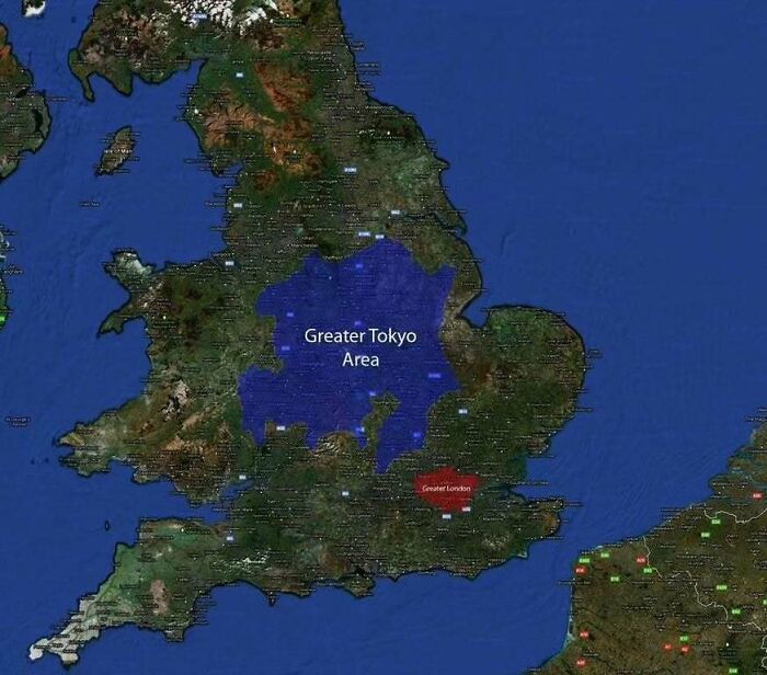
#36 Greater Tokyo vs. Greater London
© Photo: amazingmap
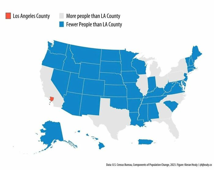
#37 Los Angeles County Has A Greater Population Than 42 U.S. States And Territories
© Photo: amazingmap
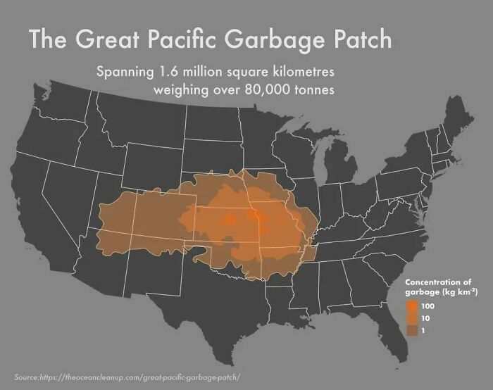
#38 What The Great Pacific Garbage Patch Looks Like Layered Over The USA
© Photo: amazingmap
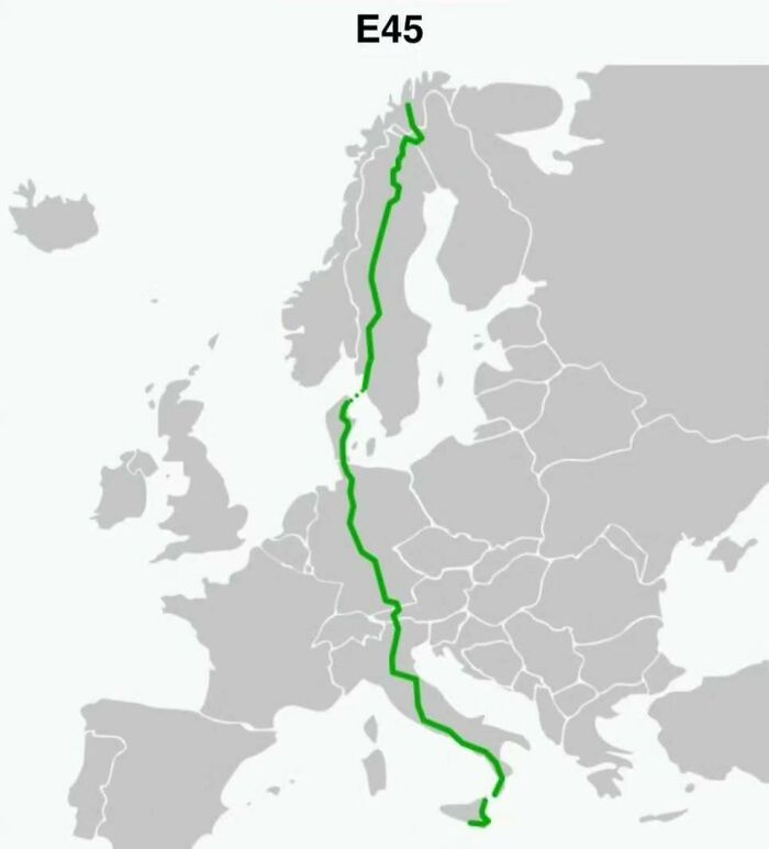
#39 Route E45. The Longest North–south European Route At 5,190km
© Photo: amazingmap
You might also like: Germany Is A Whole Different World, And These 49 Photos Are Here To Prove It
Comments are closed, but trackbacks and pingbacks are open.